
You and your team have completed building the new trail.
You’re about to open your new exhibition halls.
You are expecting hundreds of guests to show up to the event you have been planning for months.
How will they know where to go?
How will guests navigate from point A to point B?
You need the skills of a mapmaker.
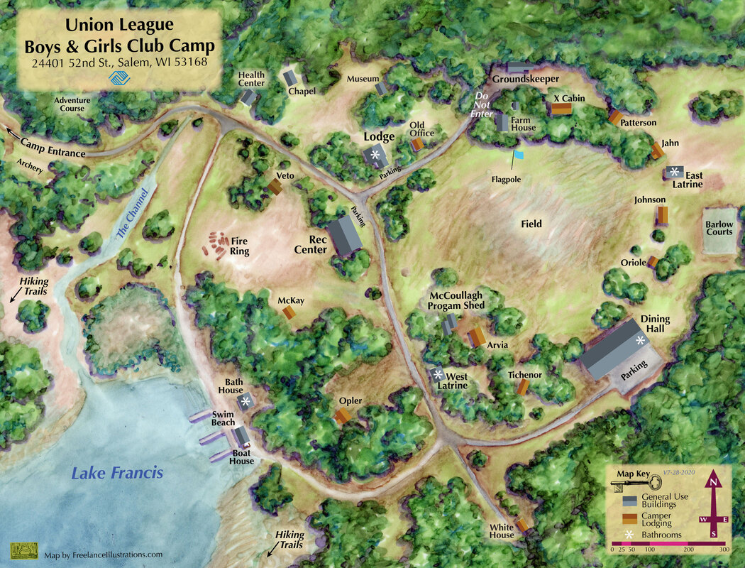
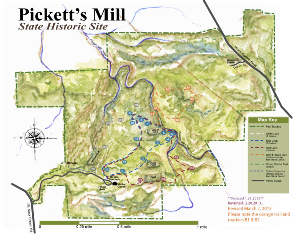
People feel more comfortable when they know where they are and where they need to go. You can provide that for your visitors by having a custom map made that’s functional and gives a sense of place.
I’ve been helping clients create custom maps for ages. I would love to create the custom map of your dreams, precisely for your needs and your space.
You’re about to open your new exhibition halls.
You are expecting hundreds of guests to show up to the event you have been planning for months.
How will they know where to go?
How will guests navigate from point A to point B?
You need the skills of a mapmaker.
People feel more comfortable when they know where they are and where they need to go. You can provide that for your visitors by having a custom map made that’s functional and gives a sense of place.
I’ve been helping clients create custom maps for ages. I would love to create the custom map of your dreams, precisely for your needs and your space.
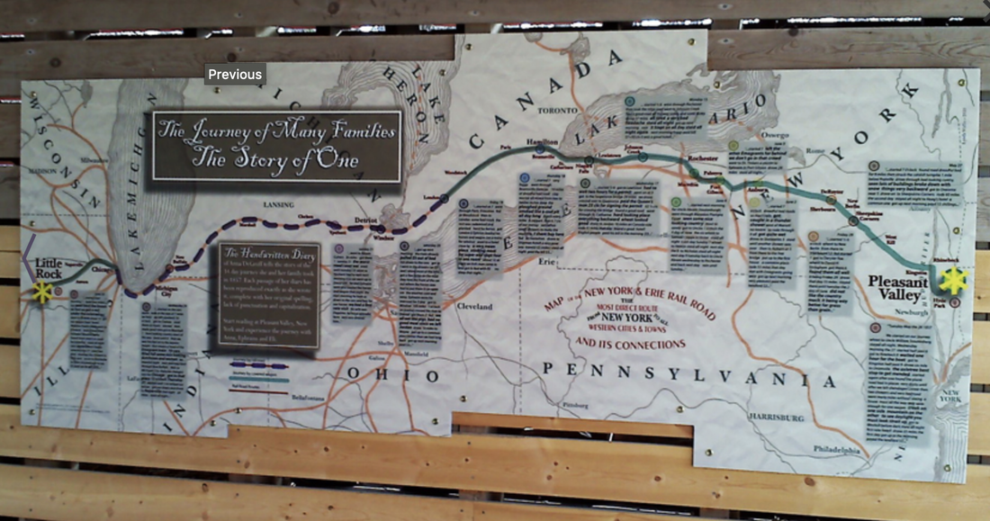
This large map panel is located in Jay Woods Forest Preserve in Kendall County, Illinois was purchased from the original family who settled the land in the mid 1800s. They loved the land. It was central to their lives and the education of their children.
We were incredibly fortunate to have access to the handwritten journal of the young mother who began her long journey from Pleasant Prairie, NY to her new home in Little Rock, IL. This eight foot long map recounts her trip west including her very real and sometimes challenging journal entries.
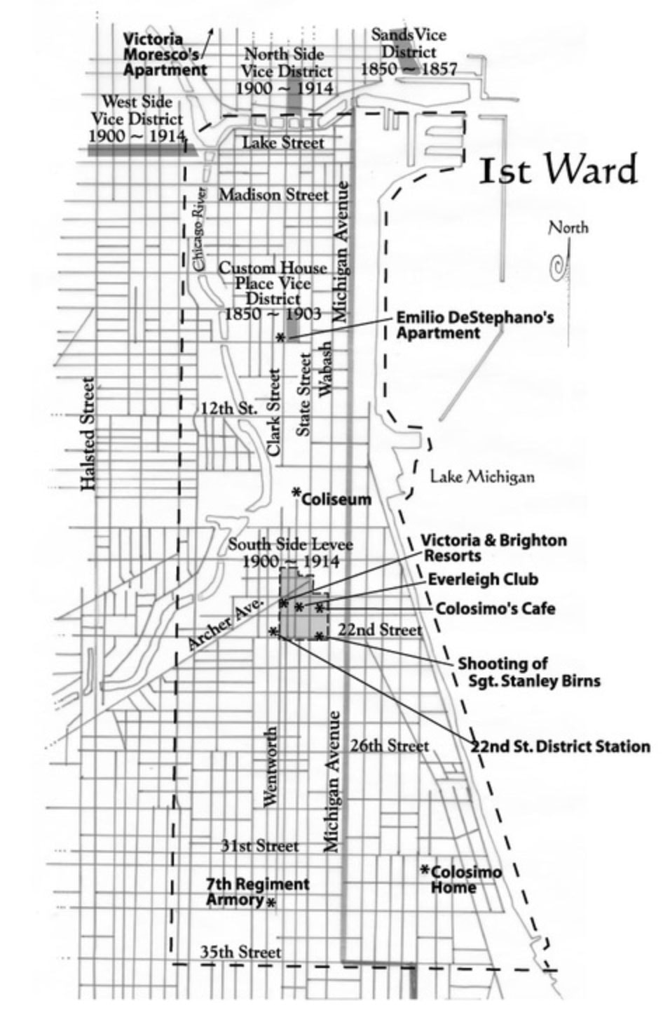
Unable to find an accurate map from the mid 1800s to use, I created this map and modeled the look and feel of my map based on historic railway maps of the era.